Tag: City map
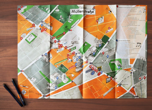
Illustrated folding plan for residents and visitors of the Aktives Zentrum Müllerstraße in Berlin-Wedding. The members of the Standortgemeinschaft Müllerstraße e.V. are marked with a numbered symbol and…
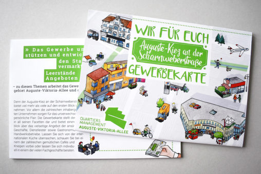
Illustration and layout of a buyers guide for the neighborhood management area Auguste-Viktoria-Allee in Berlin-Reinickendorf. The plan is drafted as DIN A1 and folded to the final format…
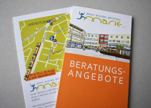
Illustrated directions by bus, train and tram. The font over the road network is handwritten. The plan was published in the Women’s Center Marie consulting flyer. Technique: watercolor,…
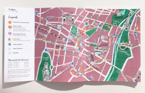
City plan of Munich commissioned by the publisher Winkler Medien Verlag. The map was printed in the exhibitors’ booklet on the occasion of the event Münchner Stoff Frühling…

Drafts for illustrated Christmas cards and New Year Wishes inspired by city and landscape maps. Do you need any cards for your business partners? All motifs can be…

New edition of the neighborhood map “Moabit’s Island” of the Berlin district Moabit with a new color scheme, fonts and format: The product was planned twice as big,…
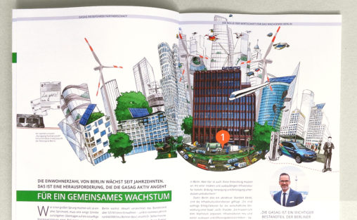
Cover and interior illustrations for the annual report 2016 with enclosed magazine of GASAG, energy company located in Berlin. Commissioning agency: IR-One AG & Co. KG. Technique: watercolor,…
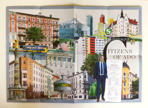
Illustrations and double-sided poster with folding map of Berlin for the Annual Report 2016 of the Real Estate Company ADO Properties S.A. Commissioning agency: IR-One AG & Co….
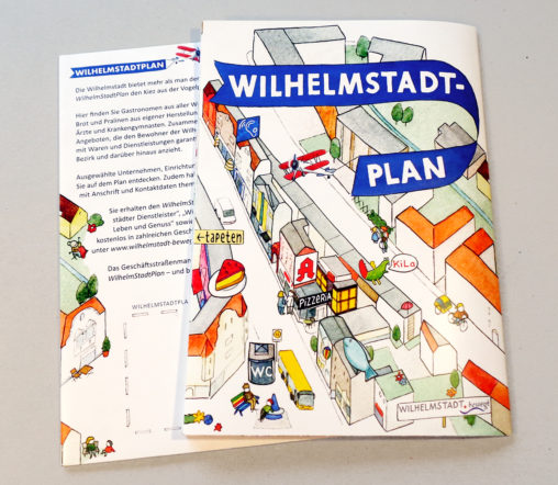
Folding map of the district Wilhelmstadt in Berlin-Spandau with traders, service providers and public facilities. Commissioners: commercial street management Wilhelmstadt and district office Berlin-Spandau. Technique: watercolor und China…

Double-sided map of Berlin with trips, districts and public transportation from the guide „Berlin – Ein Reiseheft für Besucher und neugierige Bewohner“ (Berlin – A Travel Pad for…
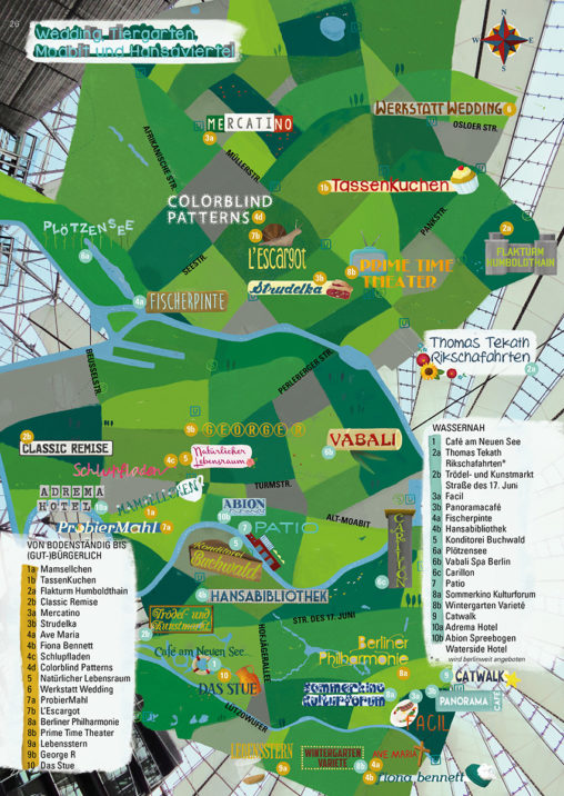
Illustrated city map of the green Berlin district Tiergarten with thematic tours from the guide „Berlin – Ein Reiseheft für Besucher und neugierige Bewohner“ (Berlin – A Travel…
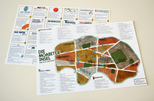
Map of the Berlin district Moabit with illustrated advertising entries for local traders: conception, illustration and layout, with the collaboration of slapa & die raumplaner GmbH. Technique: watercolor…
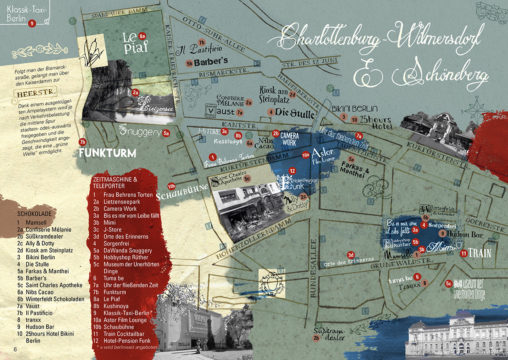
Illustrated city map of the historic Berlin districts Charlottenburg-Wilmersdorf with thematic tours and creative instructions from the guide „Berlin – Ein Reiseheft für Besucher und neugierige Bewohner“ (Berlin…
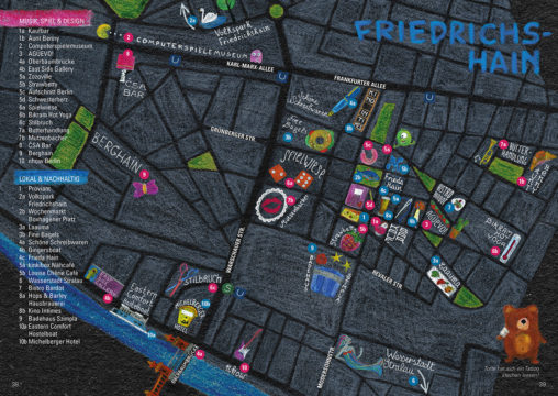
Illustrated city map of the night life Berlin district of Friedrichshain with thematic tours and creative instructions from the guide „Berlin – Ein Reiseheft für Besucher und neugierige…
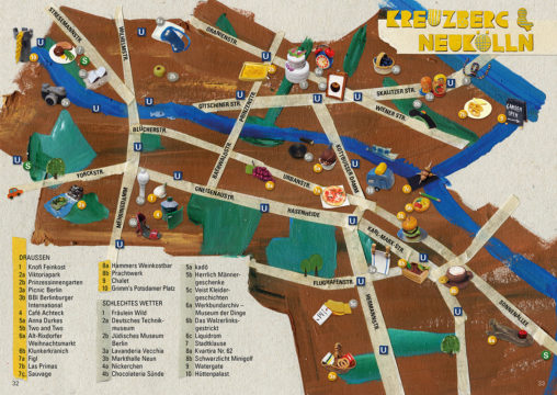
Illustrated city map of the changing Berlin districts of Kreuzberg and Neukölln with thematic tours and creative instructions from the guide „Berlin – Ein Reiseheft für Besucher und…
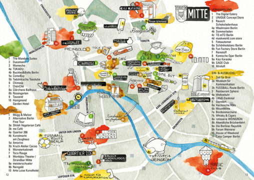
Illustrated city map of the stylish Berlin district of Mitte with thematic tours from the guide „Berlin – Ein Reiseheft für Besucher und neugierige Bewohner“ (Berlin – A…
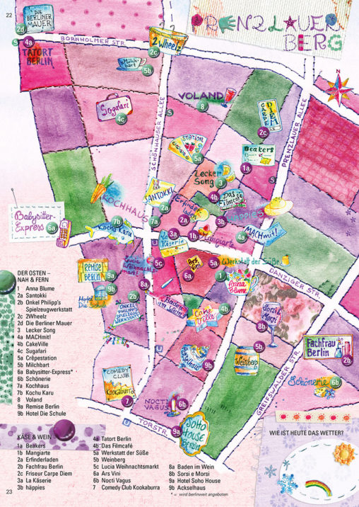
Illustrated city map of the pretty Berlin district of Prenzlauer Berg with thematic tours and an enclosed Berlin board game from the guide „Berlin – Ein Reiseheft für…
You must be logged in to post a comment.