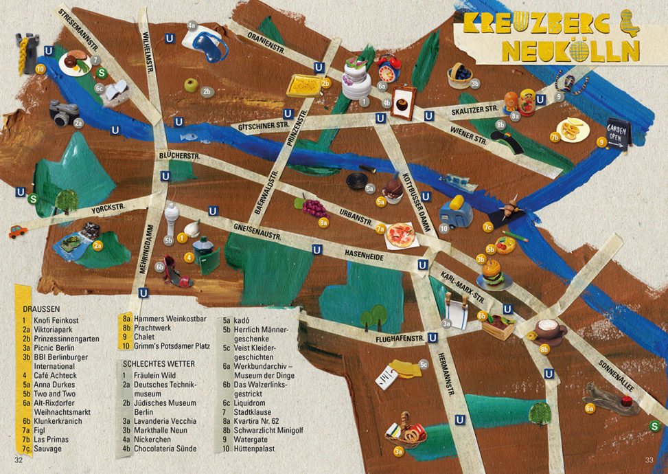
Illustrated city map of the changing Berlin districts of Kreuzberg and Neukölln with thematic tours and creative instructions from the guide „Berlin – Ein Reiseheft für Besucher und neugierige Bewohner“ (Berlin – A Travel Pad for Guests and Curious Inhabitants).
Technique: polymer clay and acrylic.